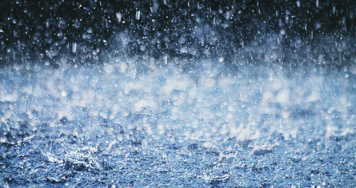
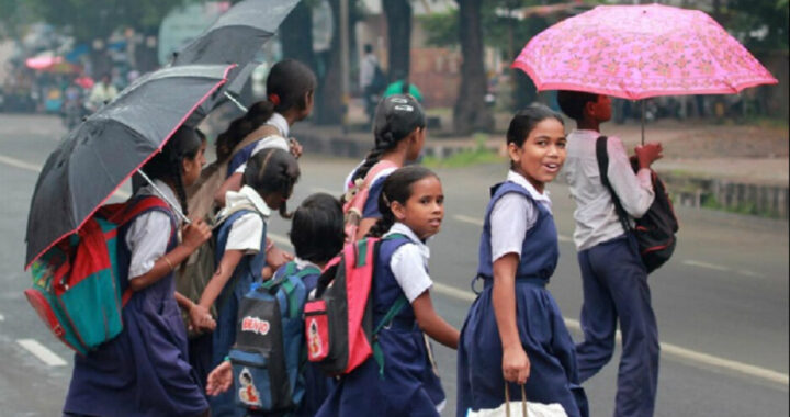
ଆଜିଠୁ ଲଘୁଚାପ : ୩ ଜିଲାରେ ପ୍ରବଳ ବର୍ଷ ନେଇ ୟେଲୋ ୱାର୍ଣ୍ଣିଂ ଜାରି

ଭୁବନେଶ୍ୱର : ପୂର୍ବ କେନ୍ଦ୍ରୀୟ ଓ ଏହାର ପାର୍ଶ୍ୱବର୍ତ୍ତୀ ଉତ୍ତର ପୂର୍ବ ବଙ୍ଗୋପସାଗରରେ ସୃଷ୍ଟ ଘୂର୍ଣ୍ଣିବଳୟ ସକ୍ରିୟ ରହିଛି। ଏହା ସମୁଦ୍ର ପତ୍ତନରୁ ୫.୮ କିମି ଉଚ୍ଚତାରେ ବାୟୁମଣ୍ଡଳ ପର୍ଯ୍ୟନ୍ତ ବ୍ୟାପିଛି। ଏହି ଘୂର୍ଣ୍ଣିବଳୟ ଶନିବାର ପଶ୍ଚିମ ଉତ୍ତର ପଶ୍ଚିମ ଦିଗରେ ଗତି କରି ଉତ୍ତର ପଶ୍ଚିମ ବଙ୍ଗୋପସାଗର ମଧ୍ୟ ଦେଇ ଉତ୍ତର ଓଡ଼ିଶା ଏବଂ ପଶ୍ଚିମବଙ୍ଗ ଉପକୂଳରେ ପହଞ୍ଚିବ ବୋଲି ଭୁବନେଶ୍ୱର ପାଣିପାଗ ବିଜ୍ଞାନ କେନ୍ଦ୍ର ପୂର୍ବାନୁମାନ କରିଛି। ଏହାର ପ୍ରଭାବରେ ଆସନ୍ତା ୨୪ଘଣ୍ଟା ମଧ୍ୟରେ ଉତ୍ତର ଓଡ଼ିଶାର କେତେକ ଅଞ୍ଚଳ ଏବଂ ଦକ୍ଷିଣ ଓଡ଼ିଶାର ଅଳ୍ପ କେତେକ ସ୍ଥାନରେ ବର୍ଷା ହୋଇପାରେ। କିନ୍ତୁ ଉତ୍ତର ଓଡ଼ିଶାର ବାଲେଶ୍ୱର, ମୟୂରଭଞ୍ଜ ଏବଂ ଭଦ୍ରକ ଜିଲାର ଗୋଟିଏରୁ ଦୁଇଟି ସ୍ଥାନରେ ପ୍ରବଳ ବର୍ଷା ହେବା ସମ୍ଭାବନା ରହିଛି। ଉପରୋକ୍ତ ଜିଲାଗୁଡ଼ିକୁ ପାଣିପାଗ କେନ୍ଦ୍ର ପକ୍ଷରୁ ହଳଦିଆ ଚେତାବନୀ (ୟେଲୋ ୱାର୍ଣ୍ଣିଂ) ଜାରି କରାଯାଇଛି। ପରବର୍ତ୍ତୀ ୨୪ ଘଣ୍ଟାରେ ଏହି ଘୂର୍ଣ୍ଣିବଳୟ ପ୍ରଭାବ ଅଧିକ ରହିବା ୧୯ ତାରିଖରେ ବାଲେଶ୍ବର, ଭଦ୍ରକ, ଯାଜପୁର, କେନ୍ଦ୍ରାପଡ଼ା, କଟକ, ଜଗତସିଂହପୁର, ଖୋର୍ଦ୍ଧା, ପୁରୀ, ନୟାଗଡ଼, ଢେଙ୍କାନାଳ, କେନ୍ଦୁଝର, ମୟୂରଭଞ୍ଜ, ସୁନ୍ଦରଗଡ଼, କନ୍ଧମାଳ, ମାଲକାନଗିରି ଏବଂ କୋରାପୁଟ ଜିଲାର ଗୋଟିଏରୁ ଦୁଇଟି ସ୍ଥାନରେ ପ୍ରବଳ ବର୍ଷା ହୋଇପାରେ। ଏସବୁ ଜିଲାଗୁଡ଼ିକର କିଛି ସ୍ଥାନରେ ପ୍ରାୟ ୭ରୁ ୧୨ ସେଣ୍ଟିମିଟରର ବର୍ଷା ହେବା ସମ୍ଭାବନା ଥିବା ପାଣିପାଗ ବିଭାଗ ଆକଳନ କରିଛି। ଉପରୋକ୍ତ ଜିଲାଗୁଡ଼ିକୁ ବିଭାଗ ପକ୍ଷରୁ ହଳଦିଆ ଚେତାବନୀ ଜାରି କରାଯାଇଛି।
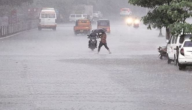
ପରବର୍ତ୍ତୀ ସମୟରେ ଏହି ଘୂର୍ଣ୍ଣିବଳୟ ଆଭ୍ୟନ୍ତରୀଣ ଓଡ଼ିଶା ଆଡ଼କୁ ମୁହାଁଇବାକୁ ଥିବାରୁ ୨୦ ବେଳକୁ ଆଭ୍ୟନ୍ତରଣ ଓଡ଼ିଶାର ସୁନ୍ଦରଗଡ଼, ବଲାଙ୍ଗୀର, ସମ୍ବଲପୁର, ବରଗଡ଼, ଦେବଗଡ଼, ଝାରସୁଗୁଡ଼ା ଏବଂ ସୋନପୁର ଜିଲାର ଗୋଟିଏରୁ ଦୁଇଟି ସ୍ଥାନରେ ପ୍ରବଳ ବର୍ଷା ହୋଇପାରେ। ଏହି ଜିଲାଗୁଡ଼ିକୁ ବିଭାଗ ପକ୍ଷରୁ ସତର୍କ ସୂଚନା ଦିଆଯାଇଥିବାବେଳେ ଉପକୂଳ ଓଡ଼ିଶାର କେତେକ ସ୍ଥାନରେ ବର୍ଷା ହେବା ଆଶଙ୍କା ରହିଛି। ସମସ୍ତ ଜିଲାପାଳ ଏବଂ ମହାନଗର ନିଗମ ଆୟୁକ୍ତ ସତର୍କ ରହିବା ପାଇଁ ସ୍ବତନ୍ତ୍ର ରିଲିଫ୍ ଆୟୁକ୍ତ (ଏସ୍ଆରସି)ଙ୍କ ପକ୍ଷରୁ ପରାମର୍ଶ ଦିଆଯାଇଛି। ଗତ ୨୪ଘଣ୍ଟା ମଧ୍ୟରେ ଗଞ୍ଜାମ ଜିଲାର ପୁରୁଷୋତ୍ତମପୁରରେ ସବୁଠୁ ଅଧିକ ବର୍ଷା ୫୪ ମିମି ରେକର୍ଡ କରାଯାଇଥିବା ବେଳେ ଶୁକ୍ରବାର ସକାଳ ସାଢ଼େ ୮ଟାରୁ ଅପରାହ୍ଣ ସାଢ଼େ ୫ଟା ମଧ୍ୟରେ କଟକରେ ୨୨ ମିମି, ଭୁବନେଶ୍ବରରେ ୪.୧ ମିମି, ଟିଟିଲାଗଡ଼ରେ ୬.୪ମିମି ଏବଂ ସୁନ୍ଦରଗଡ଼ରେ ୬ ମିମି ବର୍ଷା ହୋଇଥିବା ପାଣିପାଗ ବିଭାଗ ପକ୍ଷରୁ ସୂଚନା ଦିଆଯାଇଛି।